

 The report of the Iceland trip of May 2022. We were five, all in the picture on the left, from front to back, Jörg, me, Jenny, Tania and Allen.
We were going to go the previous year, but the Corona virus caused the Iceland authorities not to issue any visas. In between Iceland has abolished all Corona measures and my friends were able to obtain their visas, me and Jörg don't need one with our German passports.
4-May-22 Day 0
When I came to Tania and Allen to get a lift to the airport we noticed that we all had a bit of a cough. We had to tell each other, 'no coughing at the airport', since this may attract the attention of the security personnel and give us some exit problems.
But no problem, all went well, we met up with Jenny and Jörg and soon were on our way to Frankfurt. We flew Lufthansa to Frankfurt, the food was not the greatest. In fact breakfast was much below standard, the bread roll was too tough for me to eat, I just had the inside, and even that was not great, the cheese tasted like cardboard.
5-May-22 Day 1
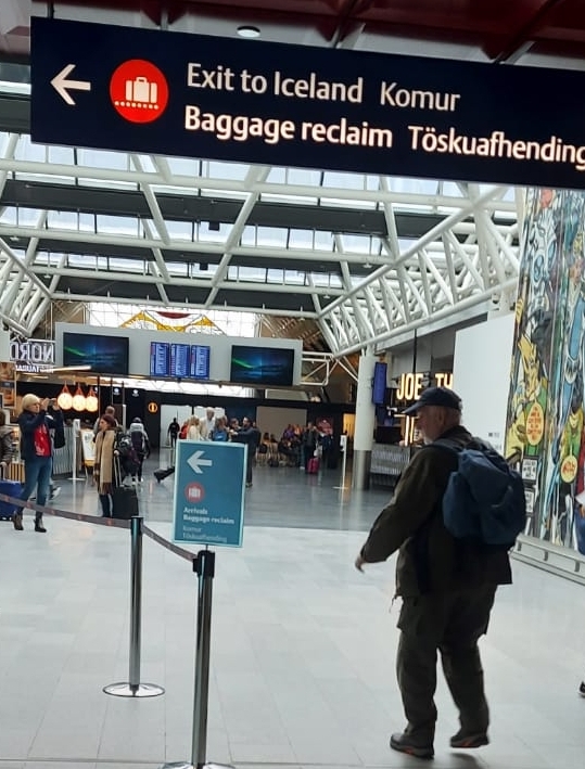 To compensate for this we bought a roll at the Frankfurt airport. Otherwise anticipating a nice lunch on the flight to Reykjavik, also Lufthansa. That turned out to be an even bigger disappointment, we got a bottle of water and nothing else. I asked Jörg, a frequent flyer, whether airline food in general has gone down in quality. He assured me that it has not, so what we have experienced was just a fluke.
 Arriving in Keflavik we collected our cars and went into town to occupy our accommodation. Had a walk through the streets nearby and stocked up on food items. Sitting down in the guest house having some lovely Caviar paste, pickled fish and some smelly cheese.
6-May-22 Day 2
First thing we had to do was to get up to the church, that would be the Hallgrimskirkja or the Church of Hallgrimur. It was supposed to open at 9h00, we wanted to see the inside of this magnificant building. It turned out that it only opens at 10. We didn't have that much time. But, just to mention, in front of the church is a monument to honour Leif Erikson. Who was he? He was the first European to set foot in America when he went on a trip west to discover America 500 years before Columbus. 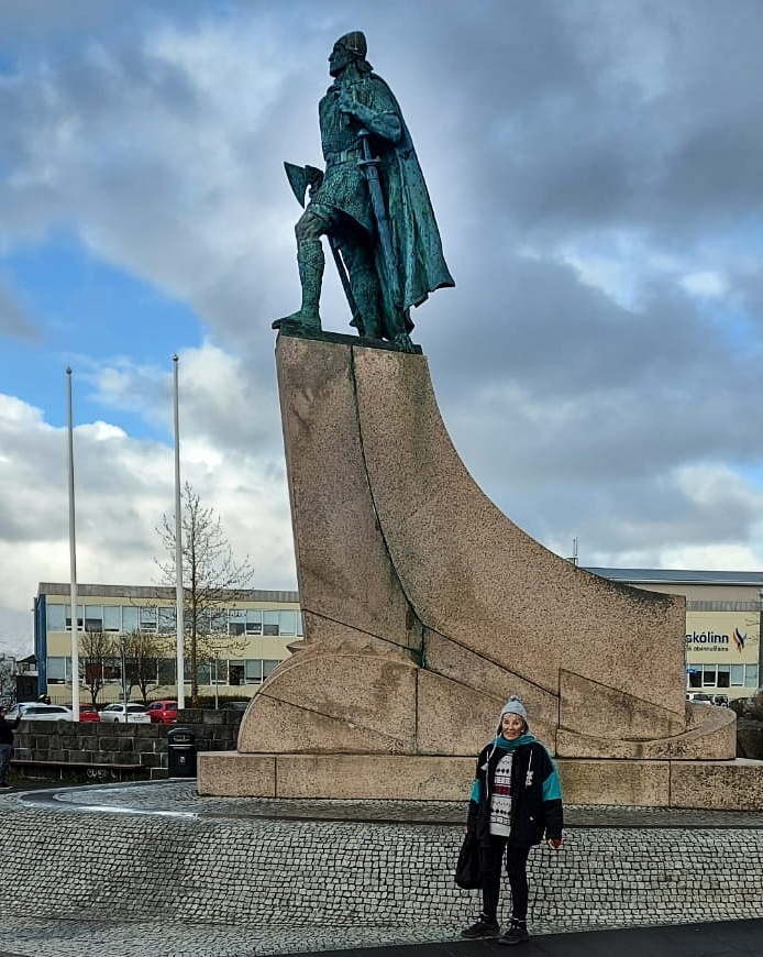 The USA sponsored the monument. I am not sure the sponsors did their homework, because Leif actually set off from Brattaslid in Greenland on this epic journey.
Collecting our stuff from the guest house we started driving north. The first point of significance was the tunnel under the sea near Akrenes. The tunnel is about 7 km long and cuts the journey to Boganes by about 60 km. Last time I went through that tunnel with Jörg 10 years ago we had to pay 1000 Krona, this time it was free. The explanation was that the loan to construct the tunnel had been paid off with the toll fees and now it is free. I think Iceland has a very decent government, our government and others could learn from that.
After Borganes we left route 1 and turned west to Snæfellsnes.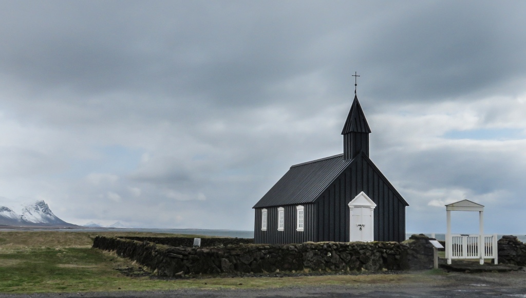 Here the first stop was at the small wooden church of Búðir. I make it easy for myself and just repeat what is stated on the the inormation board: In 1703, Berndt Lauridsen built the first church at Búðir which was demolished later and rebuilt again. In 1816 the parish at Búðir was abolished. Steinunn Sveinsdottir, oneof the ladies of the parish fought strongly for a new church, but the national rejected her request. Eventually Steinunn received royal permission to build a new one, which stood ready in 1848. A quote on the door ring says "this church was built in 1848 without the support of the spiritual fathers". In memory of Steinunn's achievement. Steinunn Sveinsdottir, this noble woman, is burried in the church yard in Búðir. Between 1984-86, the church was reconstructed and consecrated in 1987.
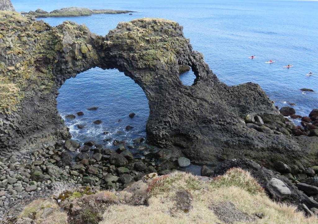 The little fishing village of Arnarstapi is a place where a major lava flow entered the sea forming a spectacular coast line of basalt columns, lava bridges and sheer cliffs.
A lava tube cave was next on the list. I was advised not to go in, because of my bad hip, the route is to rocky and uneven. So, only Jörg and Jenny went in and brought back some pictures.
After climbing an extinct volcano,Saxhólar, we got to our overnight place in Grundarfjördur.
7-May-22 Day 3
Our next overnight place was going to be in Borganes. But first we did a side trip to Stykkishólmur, it is a fishing harbour on the north coast of Snæfellsnes. A very picturesque place with colourful wooden houses, a nice wooden church and a more modern one on the hill top. A big knob of basalt with a lighthouse on top had to be ascended for a view across the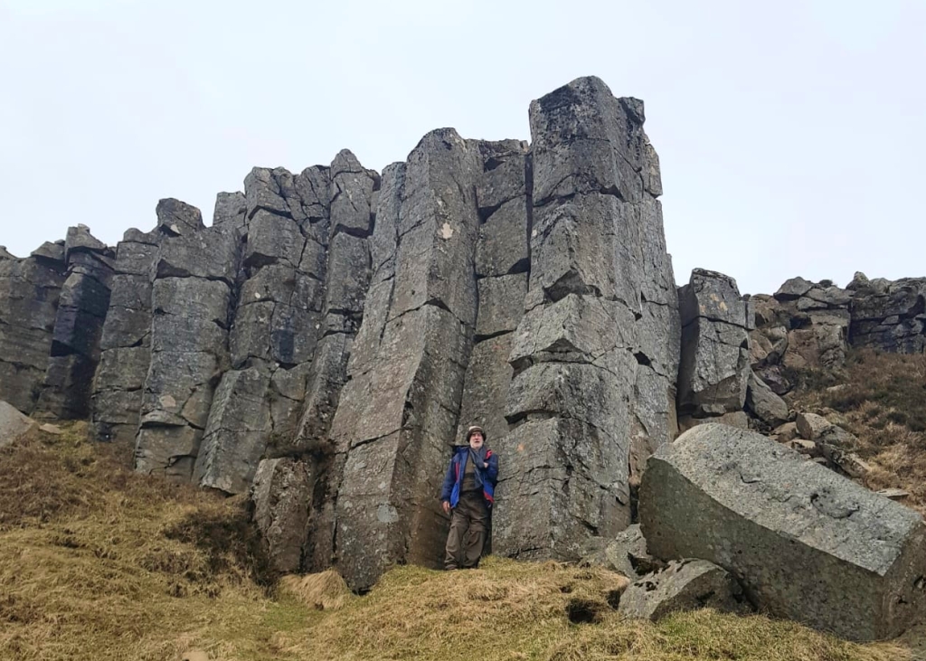 harbour and out to sea.
Retracing our steps we then took the route 56 to cross the peninsular to pick up the road to Borganes. This road goes high over the mountains and a wintery landscape. A stop was called near the top to enjoy the vista.
Between here and Borganes we only had one stop and that was at some basalt columns which the tourism department had selected as worth a stop. But not only that, there was also a little church, an abandoned house and a grave yard to be visited.
8-May-22 Day 4
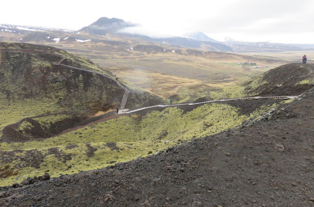 Left Boganes to get on our way north to Akureyi. The first stop was at an extinct volcano near Bifróst, named Grábrók. We could again admire what the Icelanders are doing for their tourists. A walkway and steps all the way up and partially around the volcano had been installed. The result of such a project would be to attract more tourists to the country. I think the Icelanders have the right attitude to tourism and business.
It is educational to observe how the crater came about. Lots of ash blown out from below forming the crater walls. Also to be noted is the small crater on the inside of the big crater. This would have developed from a much smaller burb or gas explosion, most likely near the end of the eruption. Grábrók is the largest crater on a 600 meter long fissure which erupted just less than 3000 years ago.
The road on took us up to an altitude of 400 meters and through an attractive wintry landscape.
 In searching for places to go, Tania had come across this natural hot pool not in the normal tourist brochures. The direction were not very precise, this did not deter us to seek it out.
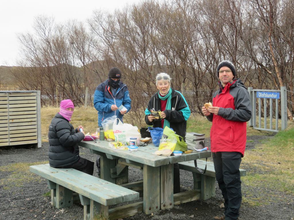
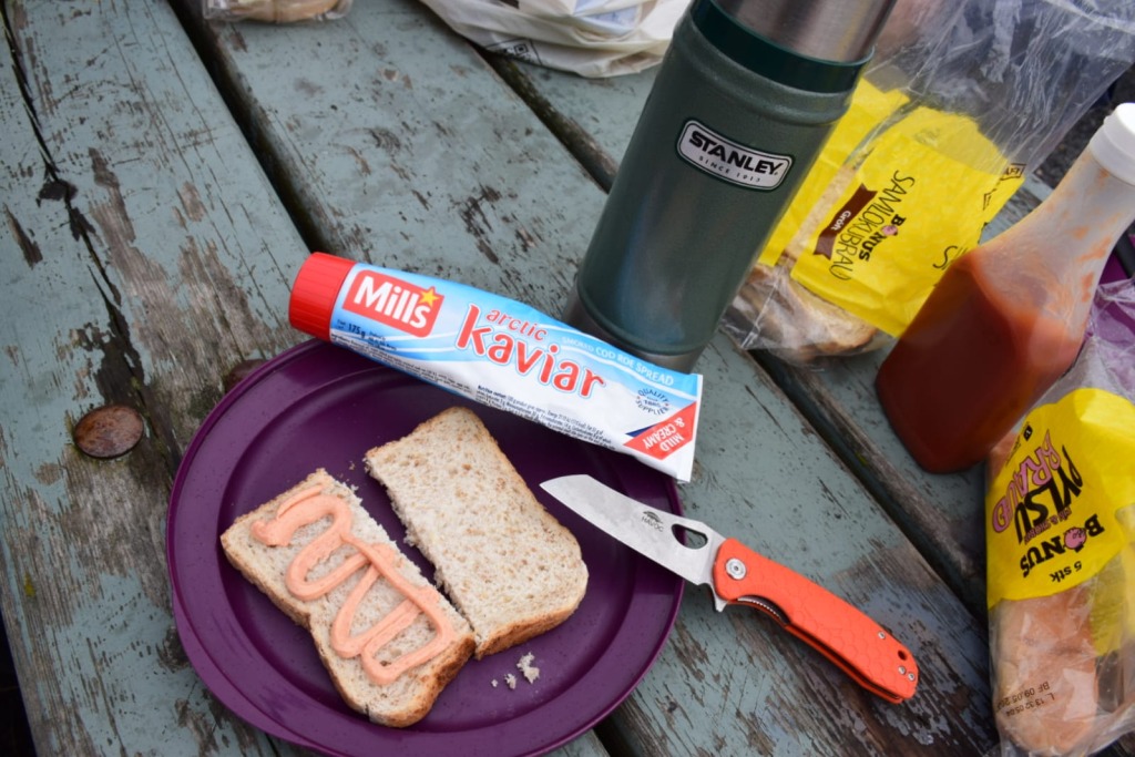
Before we did that, lunch was called for. This we had at a little wayside stop at a place called Olafslundur. In Jörg's case it was a piece of bread with the delicious Arctic Kaviar.
Success! After meandering around the country site we were eventually directed to the right spot. It is next to a waterfall, Reykjafoss, about 50 meters upstream.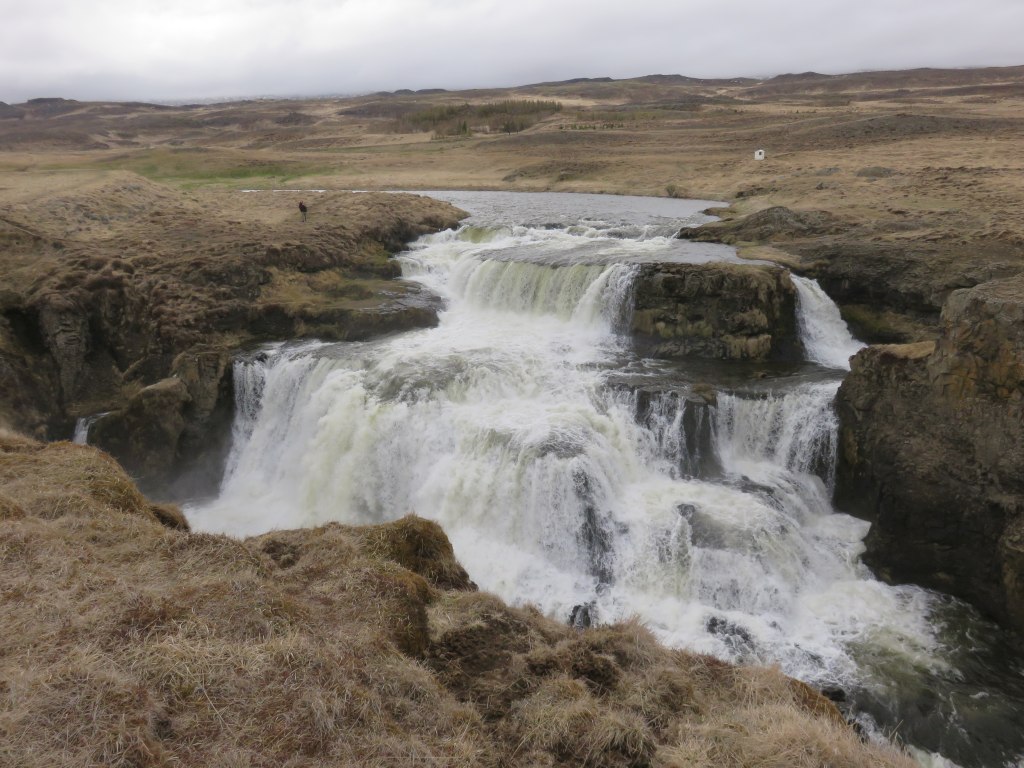 It is a medium-sized water fall. The little spot on the left bank is a person, to give it a bit of a scale.
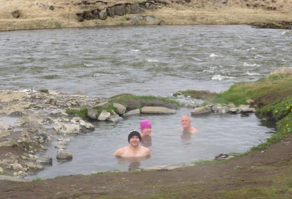 Change rooms were a bit of a problem, i.e. there aren't any. The water was a perfect 38°C, and much enjoyed by all of us. A mystery to me was how is it that it finds an equilibrium at just the right temperature. The water flowing into the pool was much hotter, it is thus a equilibrium between hot water in, warm water out and heat loss, and the balance at a suitable temperature for bathing.
From here on, it was Akureyi here we come. Commonly referred to as the capital of the North.
9-May-22 Day 5
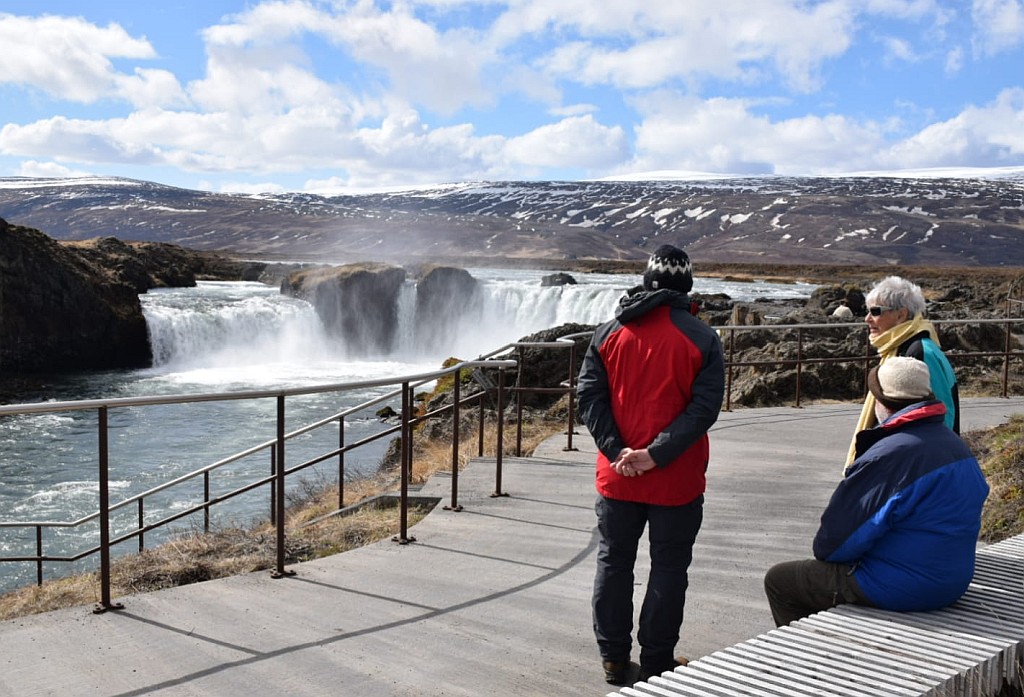 We didn't take the tunnel, which would have been much shorter, but also much less scenic. And this is why we came to Iceland. Our first stop was at Goðafoss. Translated the name means God's waterfall. The story around it is that in the time when Christianity came to Iceland, a local chief, þorgeir, accepted the conversion and when he went home collected all his status of pagan gods and threw them into the waterfall.
Forward we went, going around thee bottom of Myvatn and stopping at a place, Stútustaðir, to inspect some heaps of volcanic ash which had been spewed out. It was here that Tania discovered that we are staying here tonight. But it was still early in the day. So, we moved in and left again straight away to explore further north.
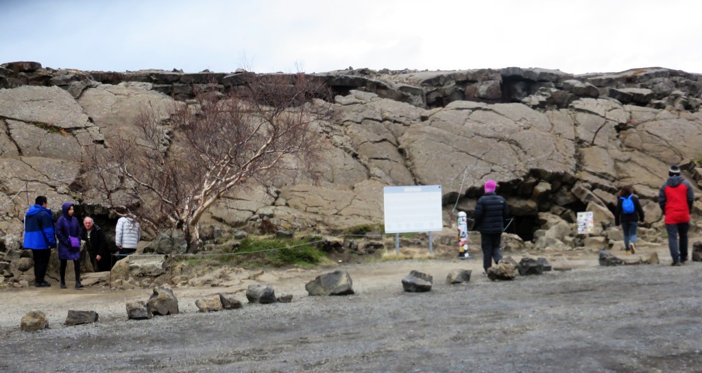 An amazing place was Grjófagjá, a cave with hot water running through it. In earlier days one could swim in the warm water there,
 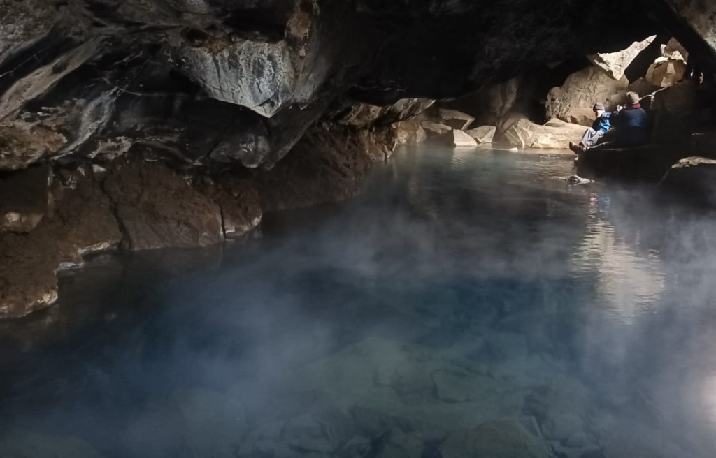 but some recent volcanic activity has shifted the equilibrium to a higher temperature. It was 43°C, just a bit too hot for the body.
Looking across the lava field it was interesting to see the many steam vents that emanates from the hot water flowing underneath. Connecting the vents one can follow the underground flow. We were here in a very active volcanic zone. Major activity took place here in recent history. It was, what is called, the Myvatn fires of 1724 to 1728, and the Krafla fires of a very recent time, 1975 to 1984. 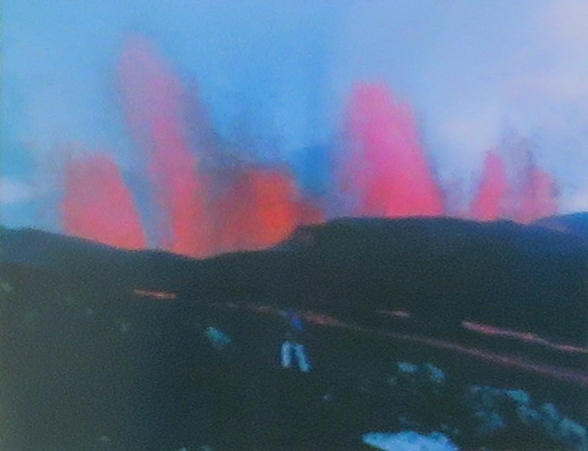 What is meant by fires is a lava eruption along the line of a fissure, such that it looks like a long line of fires. The, not so clear, picture, taken from the information board, illustrates this.
The lava at the Grjófagjá would have been from the Myvatn fires. The Krafla eruption was further north. Copying from the information board:
The Krafla Fires started with a a minor lava eruption by Leirhnjúkur. Subsequently a succession of earthquakes occurred with tectonic movement and land subsidence in Kelduhverfi (an inhabited area area further north).
During the following nine years, twenty periods of volcanic activity took place in the volcanic system. A huge amount of magma forced its way into its fissure zone and land drift of several metres took place, extending from the sands of the Jókulsa River in the North to Mt. Hverfell. The maximum drift of nine metres took place on the northern perimeter of the caldera.
The Krafla fires presented a unique opportunity to examine continental drift in a volcanic system at plate boundaries. The Krafla Fires therefore contributed considerably to the understanding of volcanic activity and continental drift.
 Powerful high temperature areas are to be found in the Krafla caldera and Mt.Namafjall intrusion of magma generates the activity. The geothermal heat has been harnessed to produce electricity in the Krafla Power Station and in Bjarnaflag.
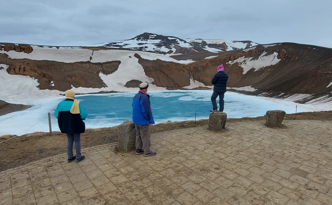
Following the road to the Krafla power station we came to the extinct volcano, Stóra-Viti. An extinct volcano which erupted in 1774 and has since been dormant. It had a blue lake at the bottom, still covered with ice. A beautiful sight.
And across from it is a thermal field, Leirhnjúkur. 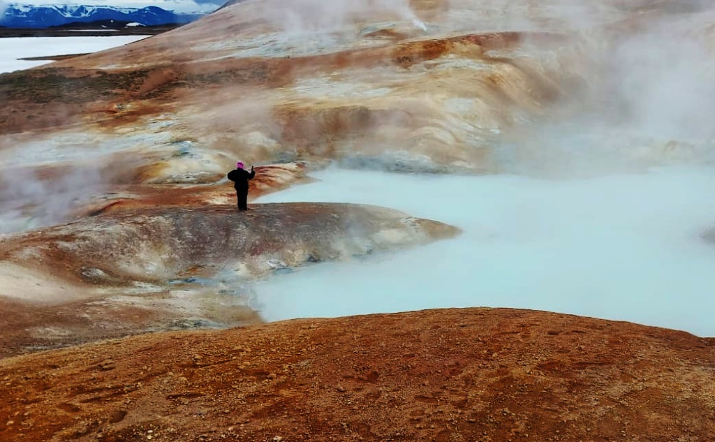
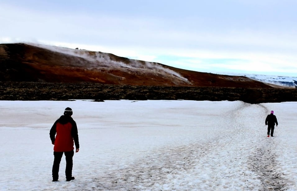
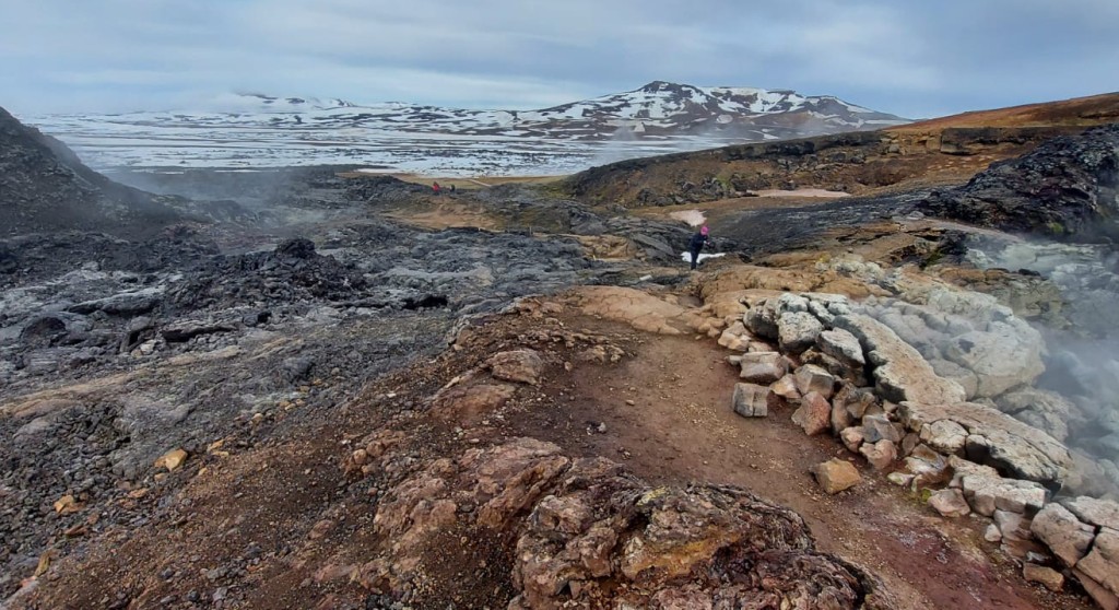 It is reached from the parking area after a one km walk. At this time of the year the trail was still over stretches of ice and snow. At the geothermal field walkways kept us on safe ground. It is hot water, mud and steam pushing through from the hot under ground. With it comes some H2S (Hydrogen Sulphide), some of the H2S oxidises to Sulphur, which can be seen as a yellow precipitate. Further up, the field is covered with lava from the 75-84 eruption. Also here the steam can be seen pushing through the top layer.
10-May-22 Day 6
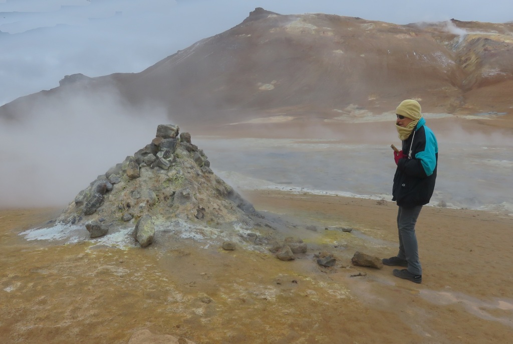
 Our first stop was going to be the Myvatn Nature Bath, a commercial hot water bath. But it was discovered they only open at 12, that was to late for us. So, we saved appr. R750 and visited the Hverir geothermal area. Another place of steam, hot water and mud.
On to Dettifoss, the route map showed us to take the 2nd road to the falls. That turned out to be a closed road. So back the way we came, about 11km back, to take the first road. The weather started to become a bit inclement, with sleet, a mixture of rain and snow, making the outside a bit unpleasant. There was no just sitting in the car, we had to braze the elements.
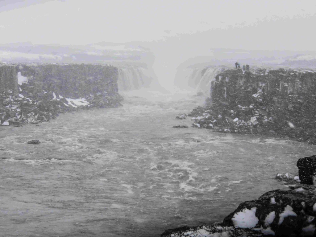
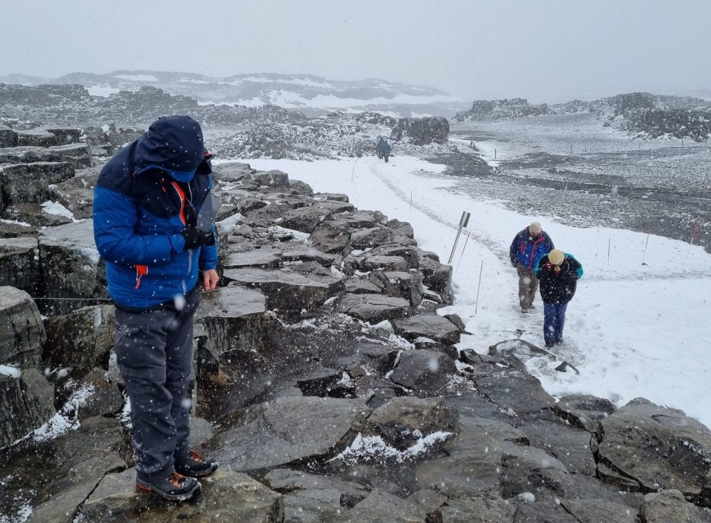 It is actually two falls, about 1 km apart. First we had a look at Dettifoss I, that was a walk of 1.5 km. The view was a bit disappointing, as can be seen in the picture, snow and mist obscuring the view. The other waterfall, Dettifoss II, another 500m hike, was much the same. But it had to be done. Anyway, I was happy to be back in the car.
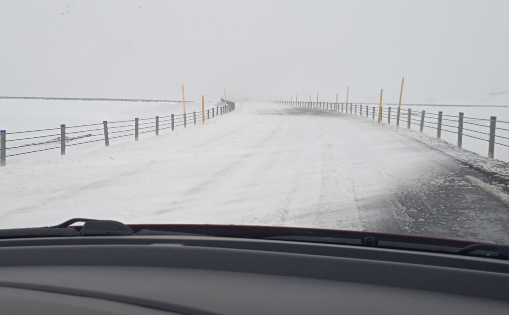 Moving forward towards Seydisfjordur things became a bit dramatic. The snow was blowing over the road at places. I had full trust in my driver, Jörg, who handled the situation very well. Once we got to lower altitude things improved, it just remained cold.
A short stop was called at the Rjúkandafoss. A multi layer waterfall very near to the road. And on to Eglisstaðir where we renewed our grocery stock. Our overnight stop was in Seydisfjordur, an other 25 km further east. This road took us to an altitude of 650m and up there road conditions were again tricky with snow on the road. It is a small town with a harbour. What I found there was of very personal interest, it was the ferry boat, Noröna, of the Smyral line. Jim and I were on it a number of years ago when we did the crossing from Thorshavn in the Faeroe islands over to Lerwick in the Shetlands. It was on this boat that I tasted my first and only Whale steak.
11-May-22 Day 7
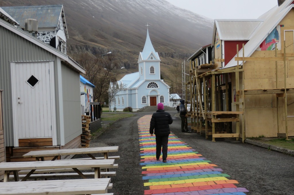 Before setting off we spent a bit of time going through the town. They have a nice church and many colourful buildings and walkway painted in the rainbow colours. This is to celebrate diversity, I do have my opinion on this, which I will not express here. Further out at the harbour is a small monument in the shape of a phone booth, it marks the spot where the first undersea cable reached Iceland in 1906.
The road going back out was still partially covered with snow, but not as bad as the day before.
From Eglisstaðir we were going to take a shortcut via route 95. But when this turned into snow covered dirt road going steeply downhill we reconsidered. The consideration was that if we had to turn back for some reason once down the steep bit, we would have a problem coming back up. So 50 km back track to Eglisstaðir and onto the N1.
 Here we had a chance to go through a tunnel for a shortcut, but decided to follow the coast line. Had a lunch break at the coast just across from the ALCOA Aluminium plant.
From here we followed the N1 going along the coast line, which meant in and out of the many fjords. The straight line distance between Eglisstaðir and Jöfn is 120 km and by road, the way we took it, 231km. Only a minor stop was called when we wanted to get some coffee/tea and cake. But the place in Djúpivogar was closed, despite being advertised on the Internet as open. On this route we also saw our first reindeer. Those had been introduced to Iceland in the 18th century. And finally we got to our over night stop in Höfn.
12-May-22 Day 8
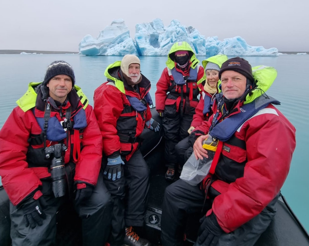
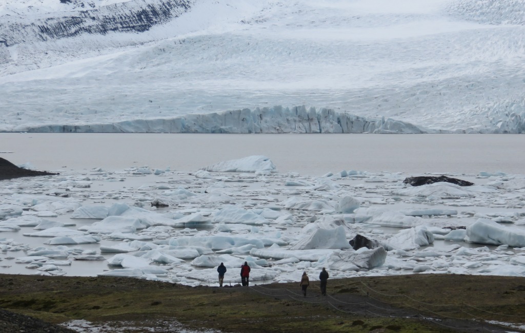
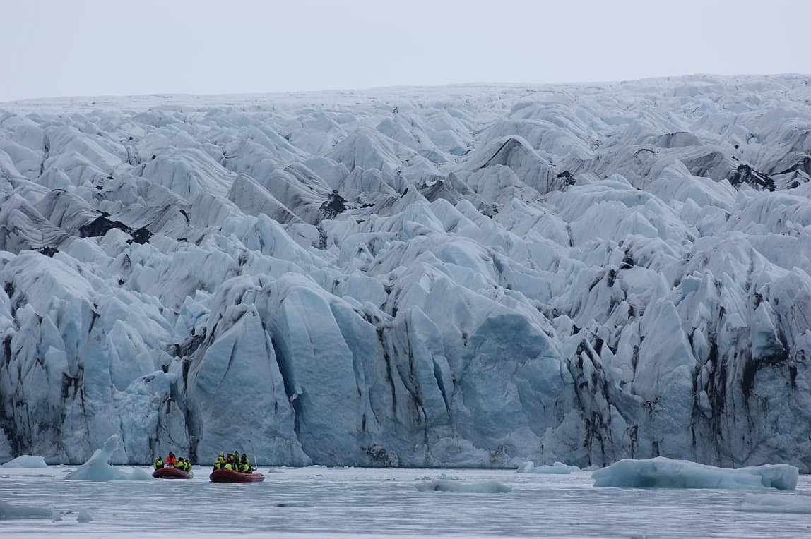 Our first aim was the glacier lake Jökulsárlón. We were in luck, when we got there to the boat place we were told that the next boat will leave in 20 minutes. We had to act quick and pay 12900 Krona (~R1500) per person. Got kitted out in a survival suit and off we went onto the boat. The aim of the tour was to go over the lake to the glacier front and on the way to observe all the various pieces of glacier floating past. The colour was fascinating from white to deep blue, the difference is caused by more or less air bubbles trapped in the ice.
Our guide and skipper, Damara, also explained how the glacier has receded over the last couple of years. That, I could confirm, because 10 years ago when Jörg and I did the same boat ride the glacier was much closer than it is now. Of course, that is due to climate change. As a climate change denier I could have had an argument, but not in such beautyful surrounding. The boat trip took about 3 hours and was well worth it.
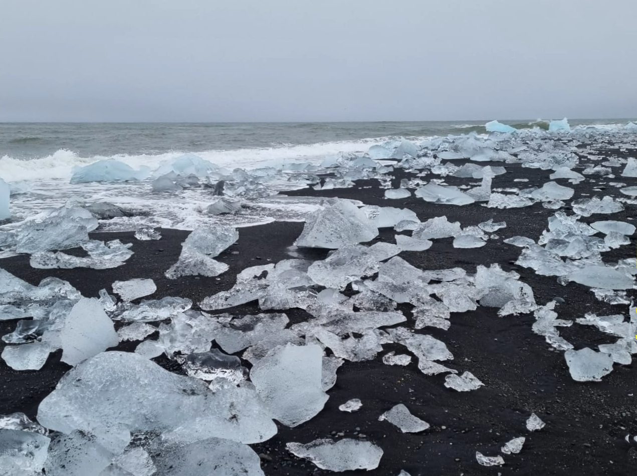
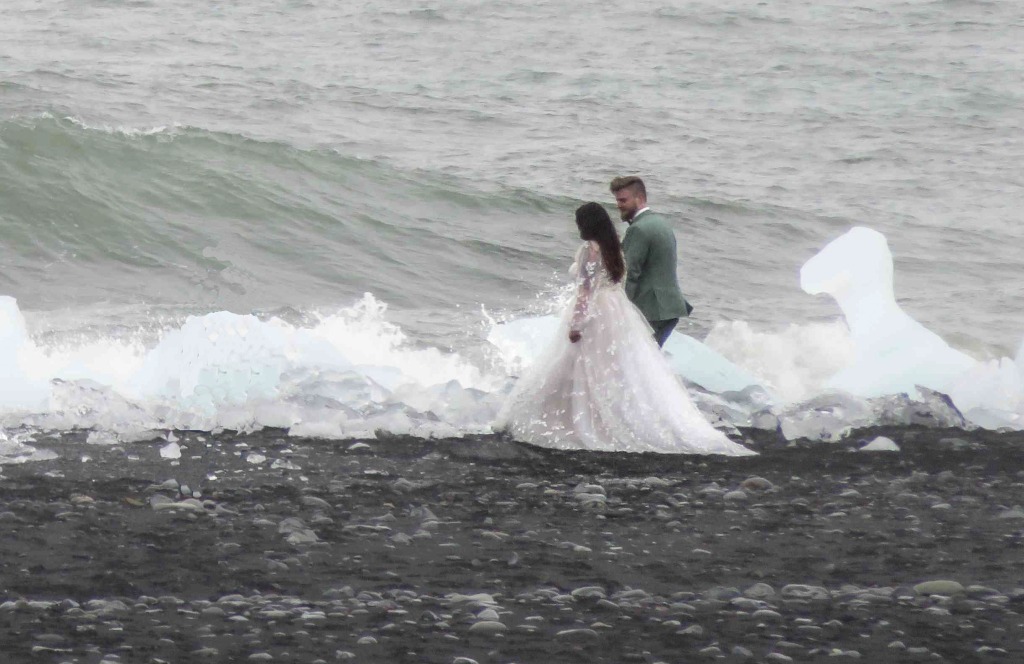 Next attraction we had to admire was the ice on the beach. This is pieces of ice that float from the lake through the river out to sea and are thrown back onto the beach. It makes for some good photographs. A special picture I managed to take was of a wedding couple at the ice beach. They were there for some wedding photos. I hope I have not broken any privacy laws by showing this picture on the internet. Something else noted by us was a 'no swimming' sign at the shore of the lake. It posed the question in our mind, who in his/her right mind would go and swim in those icy cold waters. The answer actually came from
 Damara who explained that it is part of their company culture that one has to get into this water at least once, as a sort of initiation. But, I presume they do it far from that sign.
Our next, relatively short stop was the next glacier, Fjallsjökull.
It was getting late and we had to push onto our overnight accommodation at Selfell. It was a sunny afternoon with a temperature of 7°C. Nice little church nearby.
13-May-22 Day 9
It was good bye from Sellfell, but before we did this a quick look at the turf house and the little church with a grave yard. In the grave yard we noticed a number of graves of nonagenarians, giving the impression that Iceland's people have a high live expectancy. Checking the 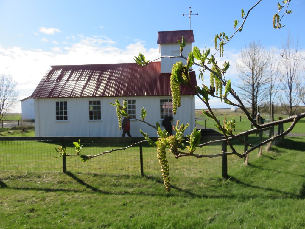 data available on the internet this turns out to be true with Iceland being in the top league of life expectancies in the world. I have to wonder why this is?
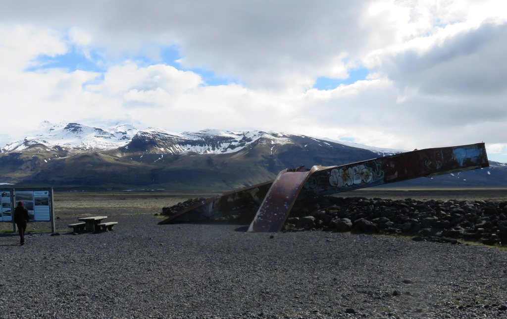 We had to back track a bit to get to Skaftafell. First place to stop was at a collection of mangled I-beams. This is what was left over from the original bridge (built in 1972) after the big flood in 1996. The flood was caused by an volcanic eruption under the ice and huge quantities of water accumulating until the 'dam broke'.
In the Skaftafell National Park we took the walk up to Svartifoss. That is that waterfall surrounded by basalt columns, a very unique feature, see the picture.
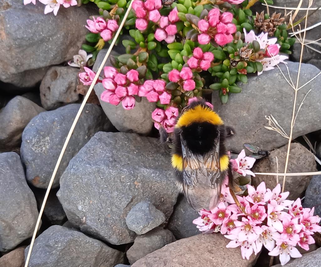
Spring was in the air and it is interesting to see nature awakening from the slumber of winter. The 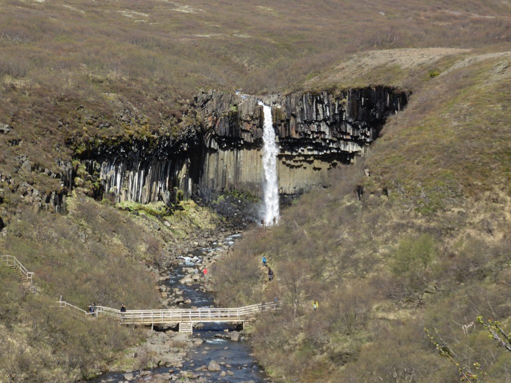 birch trees (Betula nana) were pushing out the first leaves, some willow type bushes, identified by me as Salix lanata, had their first flowers and bumble bees were around to collect some nectar from the first flowers.
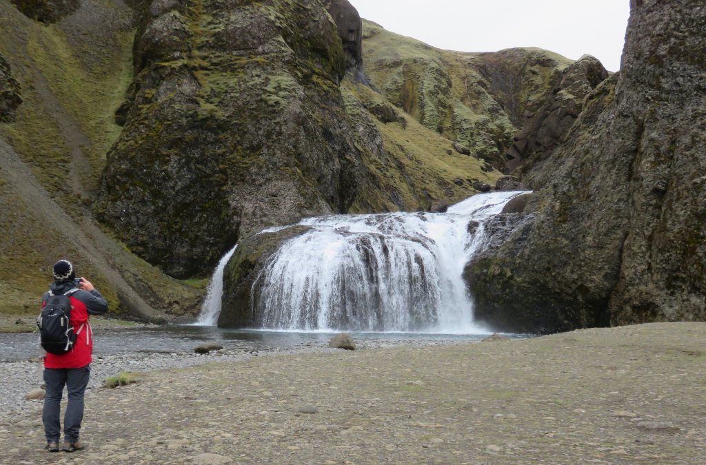
 Lunch we had in the parking area and on we had to go to a stop at Kirkjubæjarklaustur. Of interest there was a unusual waterfall, Stjórnarfoss and the church floor. The church floor attracted much interest, to explain this feature it is the easiest to copy from the information board: Kirkjugólf (the Church Floor) is an eroded and shaped columnar basalt outcrops, where the top of these vertical basalt columns can be see. The basaltic columns have traditionally inspired Icelanders and many have used their form in works of art. The columns always stand perpendicular to the cooling surface and are therefore vertical in lava flow and sills, horizontal in tunnels, but radiate out from the centre of pillow lava. When lava cools and contracts, its surface area decreases and the heat difference can be large between the upper and the lower layers. The cooling process takes a long time and as the surface area decreases, forces build up in the lava and in the end it cracks into columns, which are usually five or six sided.
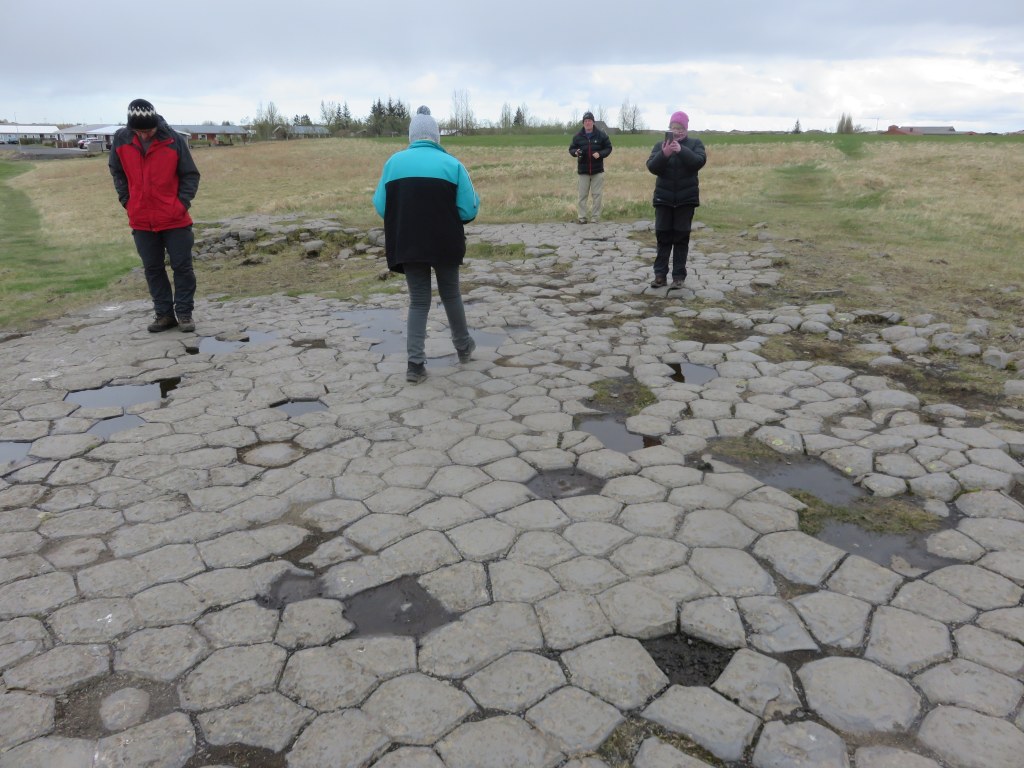
 The name Kirkjugólf infers that there was, at some point, a church in this area, and many associate this with the tales of Irish Hermits and their residence there before the settlement of Iceland. There are however, no records of a church or any other structures having been there. The texture and appearance of the outcrop has been made very smooth and regular by nature and there has been no human intervention. Kirkjugólf is archetypal of the base beneath the guardian spirit on the Republic of Iceland's coat of arms.
Our next stop was Vik where we stayed for two nights.
14-May-22 Day 10
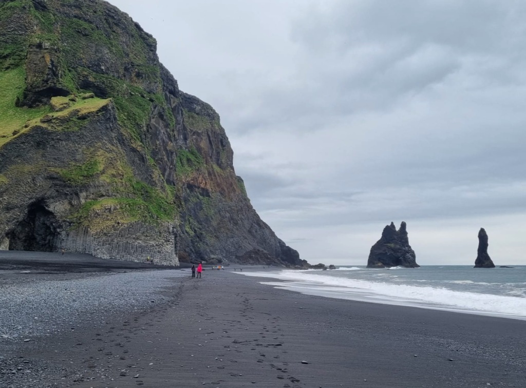
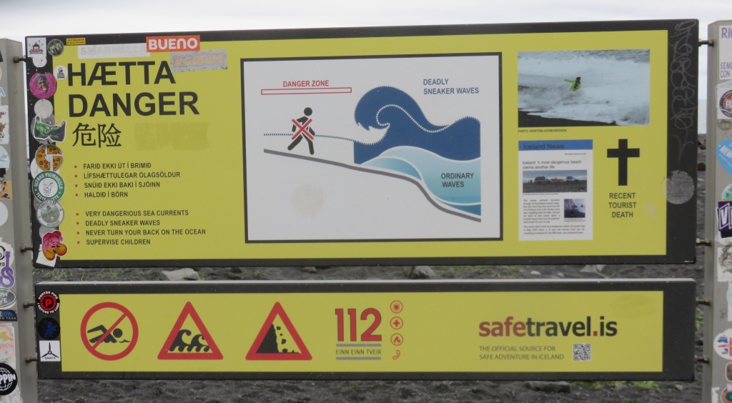 We are spending two nights in Vik. Today was thus completely dedicated to Vik and its surrounding. First was over Mount Reynisfjall and around to get to the interesting black beach of Reynisfjara with its basalt columns and lava caves.
At the parking area we noticed a couple of signs warning us tourists about dangerous sea conditions and that one should be careful at the beach. We were a bit bemused by the term 'sneaker wave', but later found that this is a serious warning. Three weeks after our return there was a news item on Iceland news that a tourist, a 80 year old man, had drowned there after one of these waves surprised him.
Very interesting lava or basalt columns and a cave, which is called 'Hálsanefshellir. It is not a cave as us cavers would define it, it is more like a overhang, but the walls formed by basalt crystals. 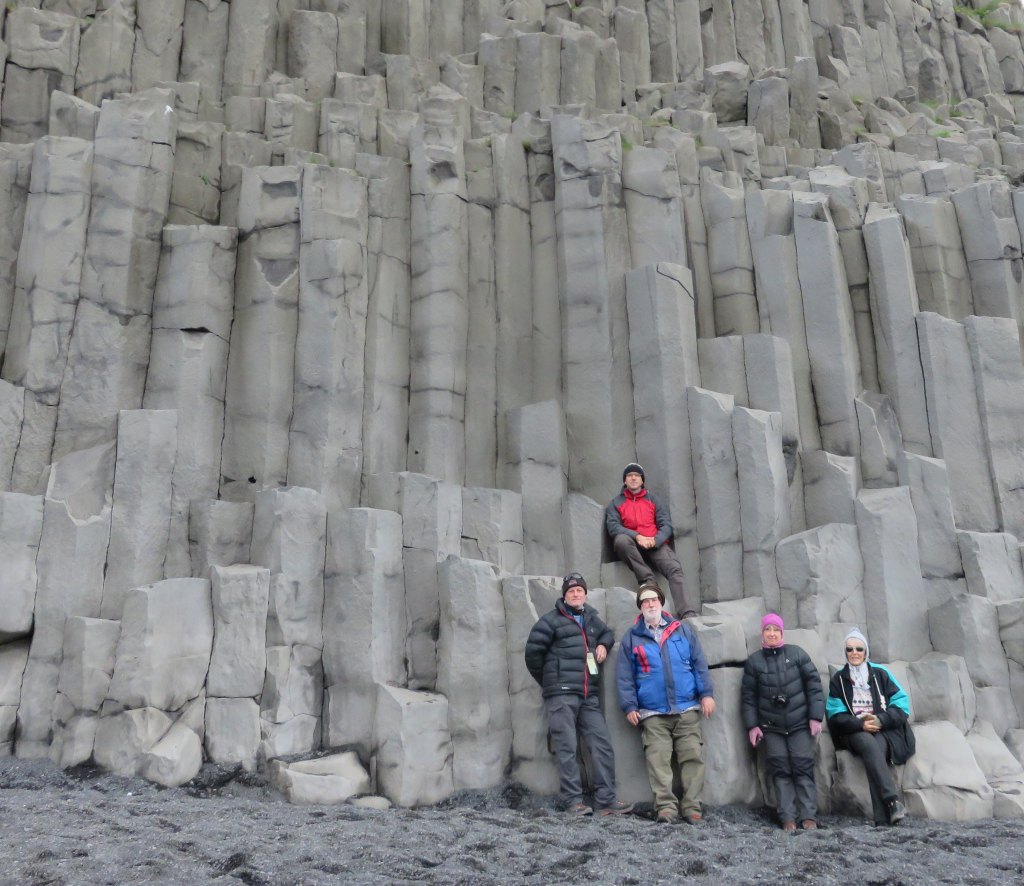 Let me quote from the information board. On the beach west of Mount Reynisfjall is the cave Hálsanefshellir, where striking columnar basalt formations can be seen. Columnar basalt is formed when magma cools slowly and cracks into columns, usually hexagonal, as the surface area decreases. The columns always stand perpendicular to the cooling surface and can be horizontal, at an incline or vertical, spreading out from the centre. The varied forms of the columns are perhaps due to this being a cross-section of an ancient volcano, as dykes, small magma chambers and lava sills can be found among other rock formations.
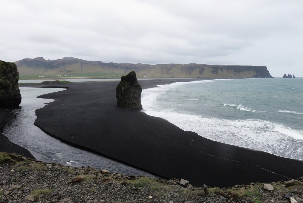 Interesting that here and at Svartifoss the crystal shape is hexagonal, but back at Kirkjubæjarklaustur at the church floor they were pentagonal. This possibly points to a different composition of the lava. Also to be noted, this is the most southerly point of Iceland.
From here we went over to the next mountain, Dyrhólaey. We had a nice view in both directions, east and west, of the black beaches.
We had lunch back home and then shopping in the afternoon, which I gave a miss. The weather was a bit miserable.
15-May-22 Day 11
Before we left Vik first a drive up to the church. This being Sunday, it should open . No luck, we found no activity around there which makes me wonder how their services are organised. Anyway, it is a nice little church situated on top of a hill overlooking the town. On a previous visit I actually did have a look inside.
Next stop was the glacier, Solheimajökull. On this route it was the last glacier we could visit before leaving the ice cap behind. 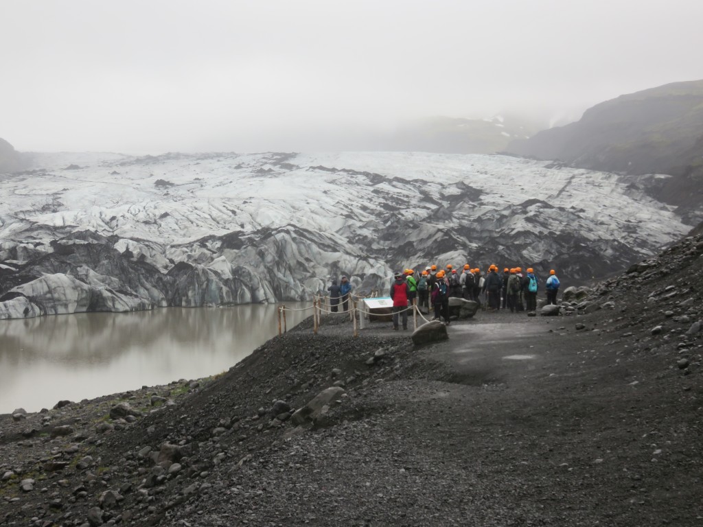 The attraction here are glacier walks but not for us, it requires a guide and some equipment. On the picture is such a group, I was listening to the speech made by the guide who explained that 10 years ago the glacier was much further out than it is now. I could confirm that because I was here with Jörg and at that time there was no lake and we were able to walk onto the ice without crossing any water.
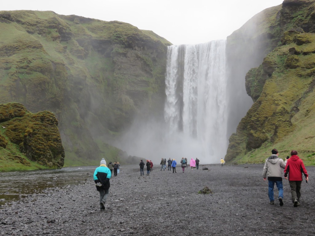 And then we got to, what I call, the most beauty-full waterfall of Iceland, Skogafoss. It impresses me so much with its single sheet of water falling 65 metres straight down to the ground.
And to the next fall, Selandfoss. Its claim to fame is that one can walk behind the fall, which, of course, we did. A short distance further is the waterfall that falls into a cave. My legs didn't carry me that far , I had visited it on a previous occasion.
On the way to our next overnight stop we made a short detour to Urriðafoss. Not much to see here, a rather shallow drop,
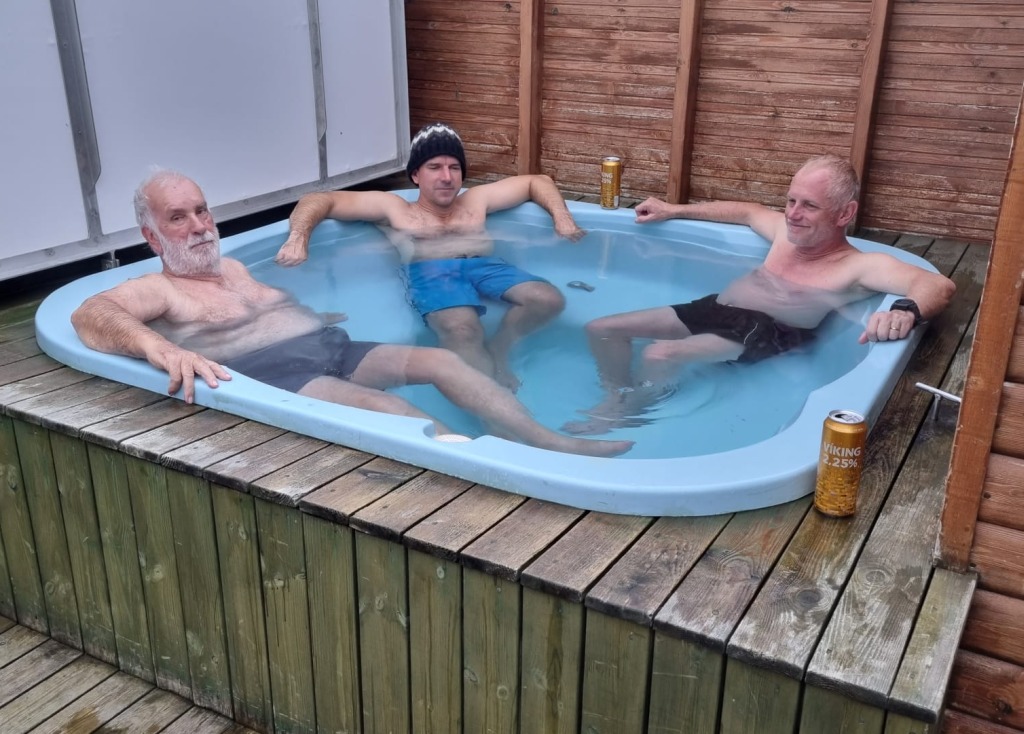 We stopped at Hveragerdi to our accommodation for the next two nights. Getting there relatively early we decided to go into town to visit the geothermal park, alas it was closed. Next try was the Horticultural Research station, but this being Sunday evening we found a closed gate. I would have loved to walk though their subtropical hothouses. My conciliation was that I did do it last time and enjoyed it. The hot tub at our hut was calling.
16-May-22 Day 12
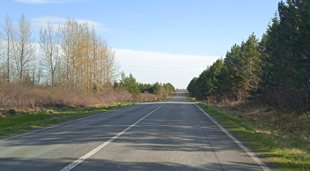 Today was the day to do the Golden Circle, that is Thingvellier, Geyser and Gullfoss. On the way north we could get a good view of progress being made with the re-forestation. This was a program initiated some years ago to replace the trees lost during the time of the settlement. But now they are experimenting with different types of trees, most of the forests in those early days were birch trees (Betula nana). What I could identify being grown there now are: Pine, Spruce, Fir and Larch. In some places I also saw some deciduous trees, most likely the Salix genus.
 The first stop was the crater of Kireð. A crater with a lake at the bottom.
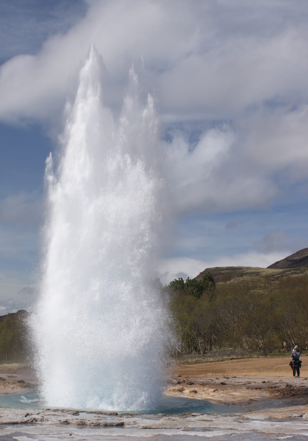
At the Geyser park many attempts were made to get a good shot of Strokur erupting. It is the only erupting geyser, at the moment pushing up every seven minutes. My impression was that Strokur is weakening, having seen it twice before.
 At the Geyser restaurant we were treated to lunch by Jenny, it was fish and chips all round. Enjoyed by us all, it was very tasty. Thank you, Jenny.
On we had to go, to visit Gullfoss. Its massiveness is impressive.
And finally Thingvelier, interesting because of the early Icelandic history and because of the geology. The first gathering, referred to as the 'thing', sat here in 930. It was a gathering of the chiefs of Iceland to discuss common issues, it was the forerunner of an Icelandic parliament. It was an event that happened every year, out in the open, until a parliament building was erected in Reykjavik in the 19 hundreds.
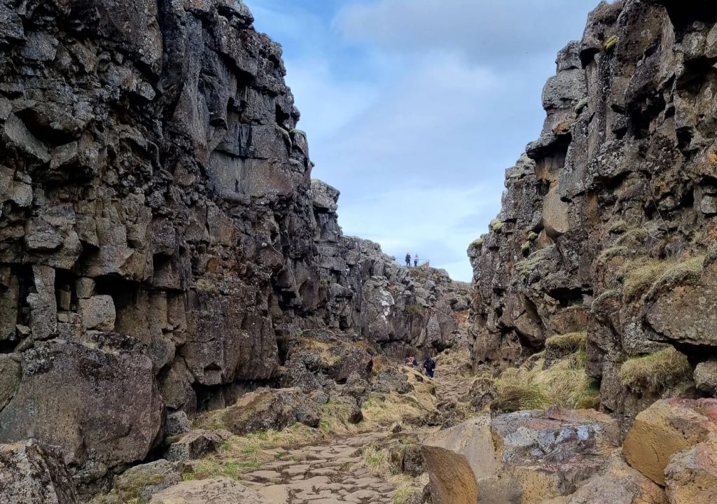 Geologically it is an interesting place where the two tectonic plates, the North American plate and the Eurasian plate, separate from each other. But it must be said that this is only symbolic, looking at the map one will notice a number of parallel rifts across the area.
17-May-22 Day 13
Jörg left today, he had to get back to work. It was decided that we should take the route to the airport through þorlákshöfn and Grindavik. 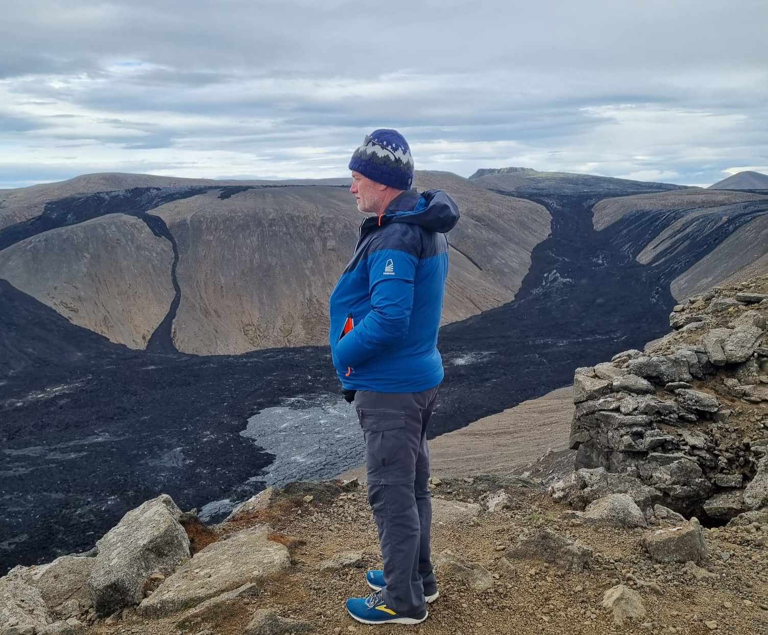 On that route there is the parking area for a walk to the recent lava out-pour at Fagradalsfjall, it had started in March last year (2021) and carried on for about 6 month. This was an interesting place to see, but not for
 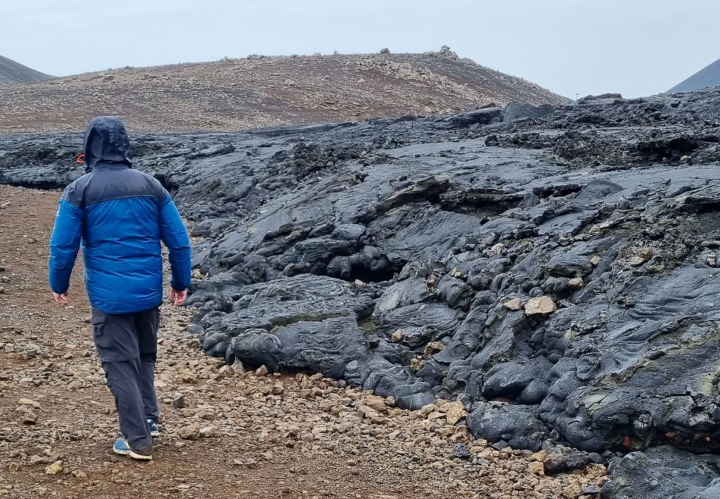 me, I had to carry on to drop Jörg in Keflavik. When I came back Jenny returned from seeing the fresh lava, Tania and Allen had walked further and came a bit later, full of excitement about such a special place. I missed out on this, but that is ok, my legs are not performing that well. After having a car lunch of left over fish and chips, we carried on.
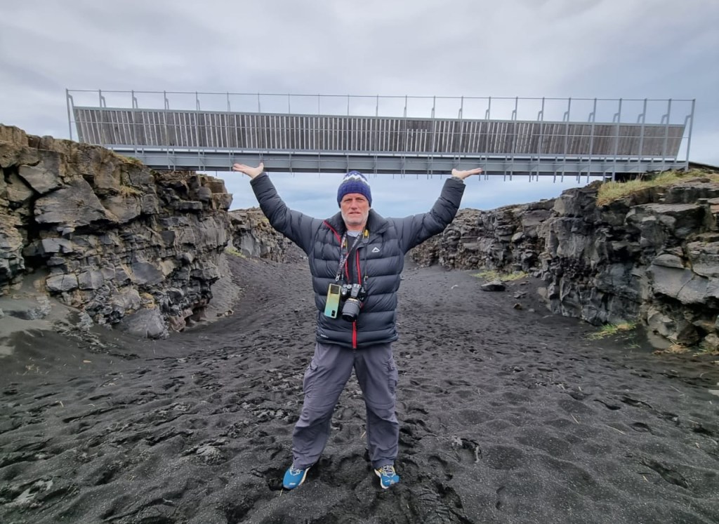
Through Grindavik we took the western loop and stopped at the Europe/American bridge. A symbolic bridge that bridges the two continental plates. That was the only stop and on we went to our hotel in Reykjavik.
That was also the end of the day for us, we tried to walk around the block a bit, but nothing was inspiring. So we made our way back to the hotel to claim our free coffee and cake.
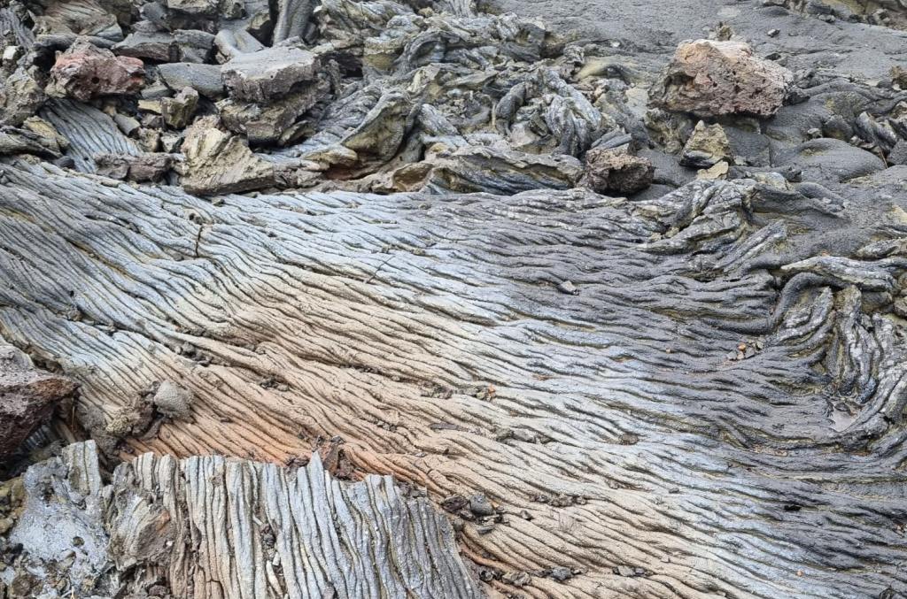 Taking stock of our food items was embarrassing, we had bought far too much food. This happened in Vik where we, or at least me, lost control and went into a food buying frenzy. A lot of the stuff we had to leave behind.
18-May-22 Day 14
Our day was taken up by doing the hop on hop off bus tour through the capital. It is a bus that goes round and round and one can hop off and hop on at any of the stops. We first took the full round tour just to spy out the place. The first hop off was at the Hallgrimskirkja, which was open for an internal inspection. Its defining features being the symbolic basalt columns, see picture on top, day 1. 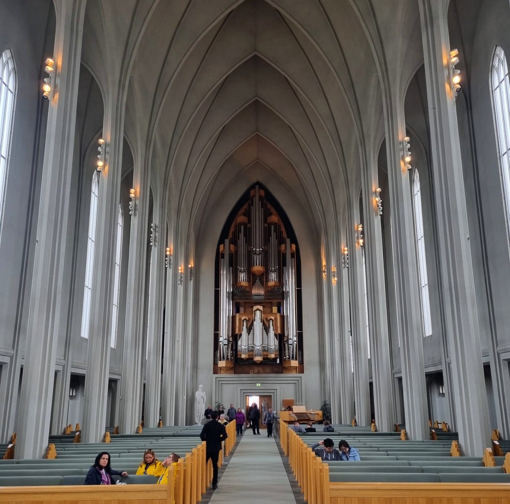
 Other details about the building and I quote straight from Wikipedia: It took 41 years to build the church: construction started in 1945 and ended in 1986, but the landmark tower was completed long before the whole church was finished. The crypt beneath the choir was consecrated in 1948, the steeple and wings were completed in 1974,[5] and the nave was consecrated in 1986. At the time of construction, the building was criticized as too old-fashioned and as a blend of different architectural styles.[6] The church was originally intended to be less tall, but the leaders of the Church of Iceland wanted a large spire so as to outshine Landakotskirkja (Landakot's Church), which was the cathedral of the Catholic Church in Iceland.
The interior is 1676 square metres.
The church houses a large pipe organ by the German organ builder Johannes Klais of Bonn. It has electronic action; the pipes are remote from the four manuals and pedal console. There are 102 ranks, 72 stops and 5275 pipes. It is 15 metres (49 ft) tall and weighs 25 metric tons. Its construction was finished in December 1992.
 We took note of the invitation to a free organ concert at 17h00 the same day.It was a short concert of only three pieces, one by Liszt and the other two by some, to me, totally unknown composers. It was mainly staged to introduce a new organist, Tuuli Rähni. The music wasn't quiete to my taste, but I enjoyed the ambience and the just-being-there.
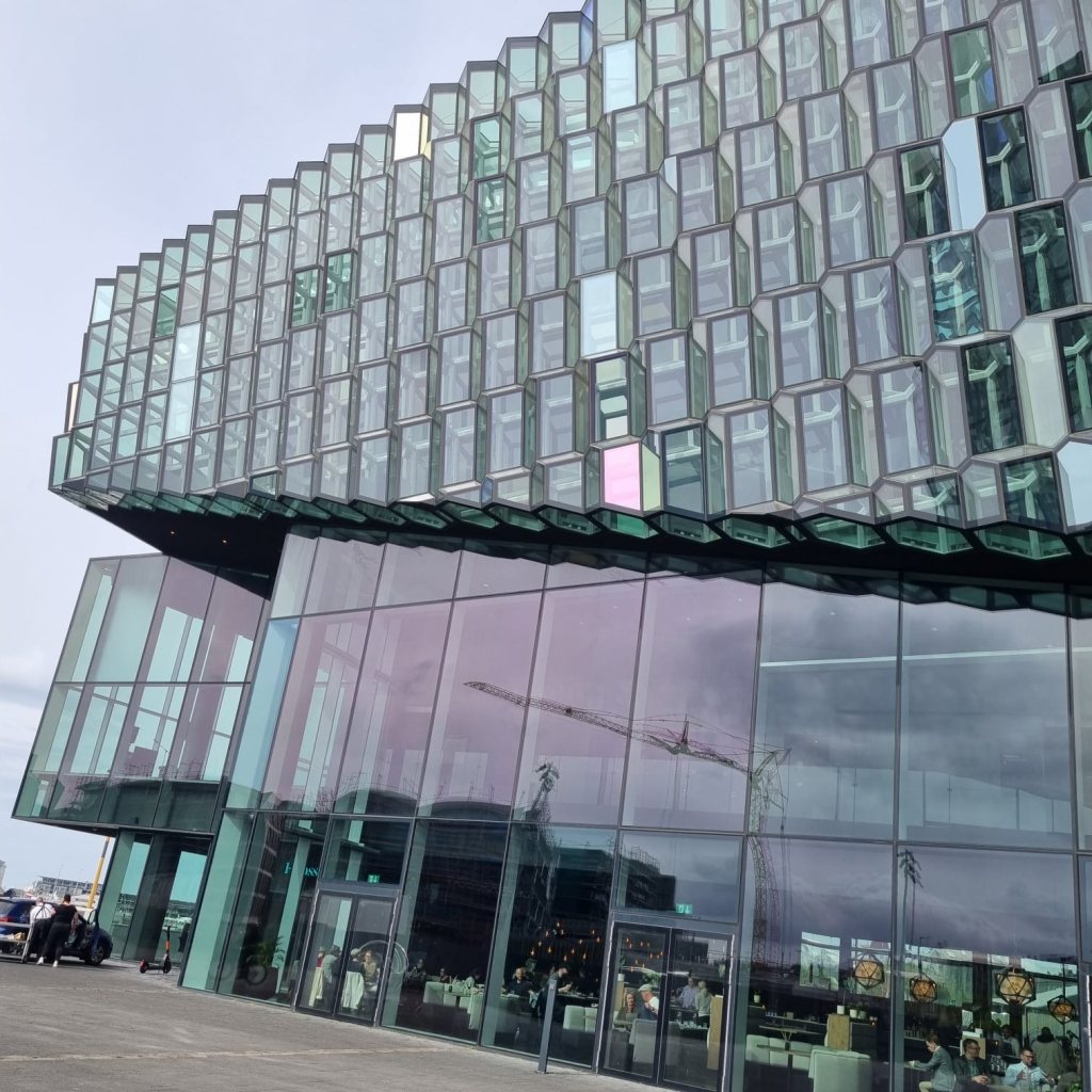
Another hop-off was at Harpa, the concert hall and conference centre at the harbour. The architecture is intriguing, Jenny was very impressed by it.
19-May-22 Day 15
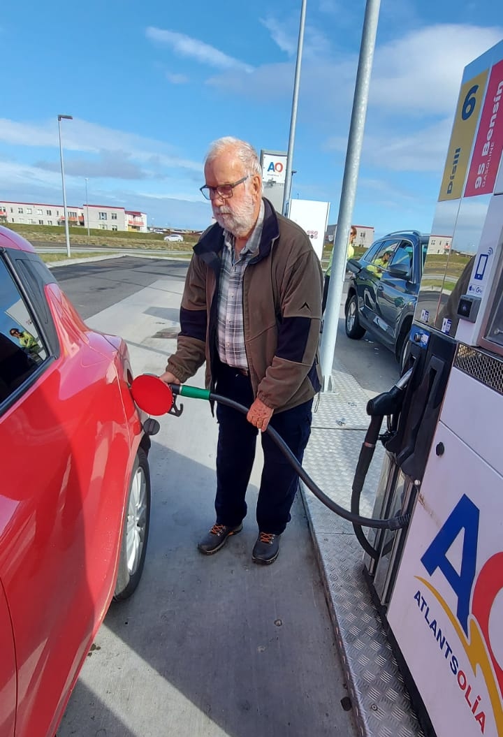 This was our last day and all we had to do was to get to the airport after breakfast. I only had a slight worry in that when we left Reykjavik I noticed our fuel gauge showed near empty and we still had to go 40km to the next petrol station. After sweating a bit, we made it. Filled up and off to hand in the car at the air port. Spent our last remaining cash on coffee and cake. Good Bye Iceland, we had a wonderful time.0>
Just some concluding remarks. The pictures I have used in here are not all mine, in fact less than half are. I cannot acknowledge the author of each pictures, I can only say I have used pictures from Tania, Allen, Jörg and Jenny. 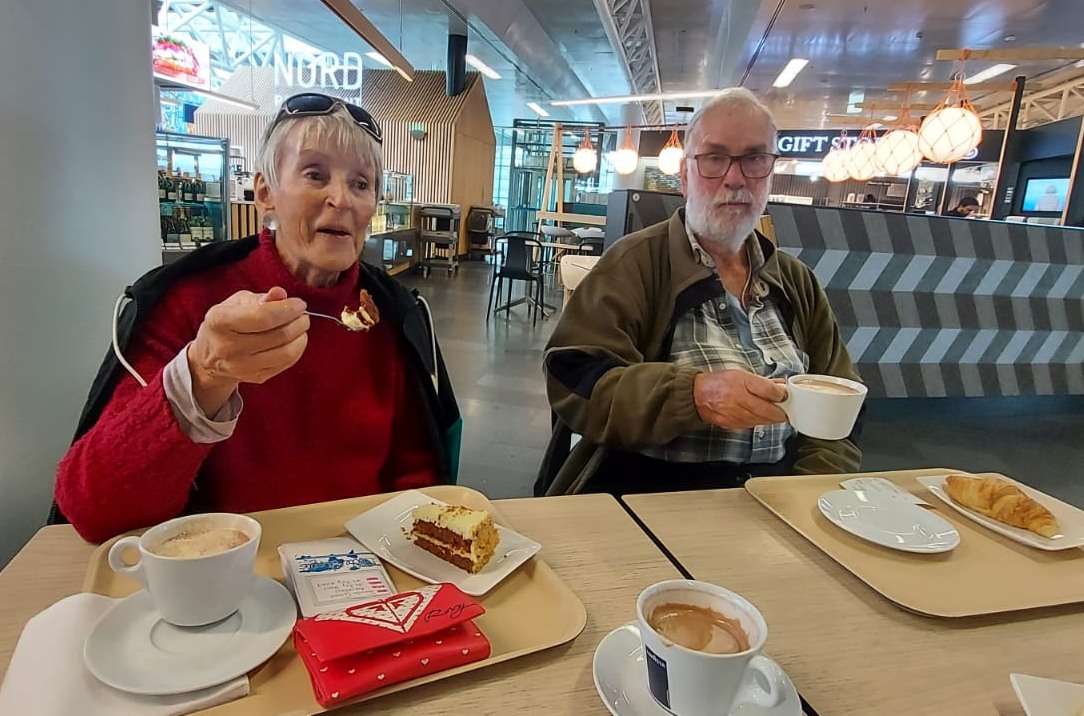 And a thank you to all the team members, we did not have a single argument in connection with our travels. We may have had disagreements about things like climate change and Corona vaccination, but we are adult enough to accept our differences.
And thank you to Iceland for being such a well organised country.